The California Incline
- Known As
- The Incline
- Architect
- –
- Built
- 1905
- Designated
- –
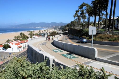
Going west on California Avenue across Ocean Avenue, the roadway opens to a breathtaking view of Santa Monica Bay and the Malibu coast. For the next 1,400 feet, the road descends the nearly vertical face of the rugged Palisades bluffs, ending at Pacific Coast Highway. This is the California Incline, both a vital traffic route and one of Santa Monica’s most stunning visual experiences.
In 1902, there were two safe ways to get to the bottom of Santa Monica’s bluff. A staircase at Arizona Avenue, known as the 99-Steps, and via a bridge that passed from Linda Vista Park (now Palisades Park) to the top floor of the North Beach Bathhouse on Broadway. An idea was put forth for bluff inclines at the foot of several other avenues in the city to improve beach access.
Circa 1905, view of the Santa Monica shoreline from Palisades Park. The tracks of the Los Angeles & Independence R.R. run where the Pacific Coast Highway is today. Photo: Water and Power Associates
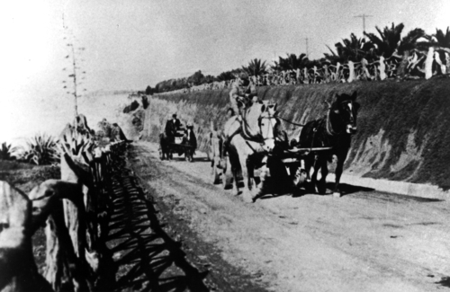
In 1905, City engineer Thomas H. James’ plans for three inclines were funded and ready to break ground. A foot path departing from Idaho Avenue would meet a vehicular roadway departing from California Avenue halfway down the bluff-face. The two would continue to the beach as one multi-modal route spanning over 1700 feet long. The third incline was built for pedestrians at the foot of Oregon Avenue (now Santa Monica Boulevard).
Originally referred to as the Oregon Trail, it became known as the Sunset Trail in 1916. Linda Vista Walk from Idaho Avenue is now called the Idaho Trail, and Linda Vista Drive from California Avenue is now known as the California Incline. All three inclines were provided with rustic fencing for safety, which was also installed along the bluff edge of Palisades Park.
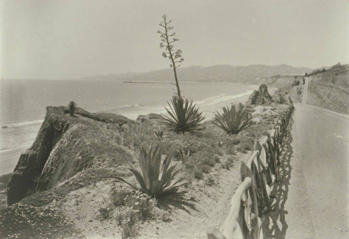
Looking west from the California Incline in Santa Monica to the Santa Monica Mountains, 1915. Photo: Santa Monica Public Library Imagine Collection
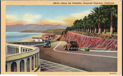
In 1932, the PWA funded a widening project that increased the California Incline from twenty to forty feet wide. The beach road was also widened to extend the interstate Roosevelt Highway through Santa Monica. And the funds allowed for resurfacing and repairs to the Sunset and Idaho Trails. A neon sign marking road trippers’ arrival in Santa Monica was added to the California Incline by local boosters in 1934.
In the early 1990s, the California Incline was deemed “structurally insufficient” and in 2007, funding was finally secured to rebuild the historic structure, most of it from a welcome federal grant. In April 2015, after more bureaucratic delays, the California Department of Transportation, in partnership with the City of Santa Monica, began construction of a new bridge that met current seismic standards while paying homage to the Incline’s PWA-era look as seen in the rebuilt balustrade, and the restored neon sign.
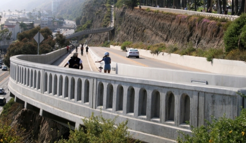
Reopened with much civic fanfare on September 1, 2016, today’s Incline consists of a reinforced concrete slab supported by 96 concrete pilings thrust deeply into the bluffs. Over 1,000 soil nails stabilize the erosion-prone sandstone along the eastern edge of the bridge.
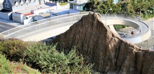
The expanded Incline is now multi-modal, accommodating three lanes of traffic, as well as walking and biking lanes that have become popular with families and fitness buffs alike. Two new pedestrian bridges, impressive in their own right, connect to the Incline, one leading back up the bluffs to Palisades Park and the other down to the beach.
In addition to its contributions to the mobility and magnificence of Santa Monica, the California Incline has played a role in pop culture, appearing in TV shows and such films as It’s a Mad, Mad, Mad, Mad World (1963) and Knocked Up (2007). The Incline has also been an element in novels, including In A Lonely Place by Dorothy B. Hughes (1942) and the Harry Bosch detective series. It is also featured in the popular video game series Grand Theft Auto.
Sources:
City of Santa Monica, “Santa Monica Constructs the Future, California Incline Replacement,” 2014.
Fresco, N., 2020. Along Came Jones. Unpublished manuscript, 2020.
Garbee, J. et al, Hometown Santa Monica: The Bay Cities Book, 2007.
KCET, “When Model T’s Scaled Santa Monica’s California Incline,” Sept. 8, 2016.
LA Times, “California Incline in Santa Monica Reopens to Traffic After 17-month Closure,” Sept. 1, 2016.
